
The hardware and bandwidth for this mirror is donated by dogado GmbH, the Webhosting and Full Service-Cloud Provider. Check out our Wordpress Tutorial.
If you wish to report a bug, or if you are interested in having us mirror your free-software or open-source project, please feel free to contact us at mirror[@]dogado.de.





rasterpic is a tiny package with a single goal:
geotag an image and return a terra
SpatRaster object using coordinates from supported spatial
input classes (see ?terra::SpatRaster).
[!NOTE]
This package is stable and maintained on a best-effort basis. I currently prioritize CRAN compatibility, bug fixes and regressions over new features.
Install rasterpic from CRAN:
install.packages("rasterpic")Check the documentation for the development version at https://dieghernan.github.io/rasterpic/dev/.
You can install the development version of rasterpic with:
# install.packages("pak")
pak::pak("dieghernan/rasterpic")
Alternatively, you can install rasterpic using the r-universe:
# Install rasterpic in R.
install.packages(
  "rasterpic",
  repos = c(
    "https://dieghernan.r-universe.dev",
    "https://cloud.r-project.org"
  )
)rasterpic_img() can geotag an image from several spatial
input classes:
sf, sfc,
sfg and bbox.SpatRaster,
SpatVector and SpatExtent.stars.c(xmin, ymin, xmax, ymax).rasterpic_img() is an S3 generic. Methods for
extent-like inputs use the object extent, and vector methods can also
mask the image to the object shape.
This example uses an sf object:
library(rasterpic)
library(sf)
library(terra)

# Use the flag of the United Kingdom.
img <- system.file("img/UK_flag.png", package = "rasterpic")
uk <- read_sf(system.file("gpkg/UK.gpkg", package = "rasterpic"))

class(uk)
#> [1] "sf"         "tbl_df"     "tbl"        "data.frame"

# Geotag the image.
uk_flag <- rasterpic_img(uk, img)

uk_flag
#> class       : SpatRaster
#> size        : 400, 800, 3  (nrow, ncol, nlyr)
#> resolution  : 5398.319, 5398.319  (x, y)
#> extent      : -2542183, 1776472, 6430573, 8589900  (xmin, xmax, ymin, ymax)
#> coord. ref. : WGS 84 / Pseudo-Mercator (EPSG:3857)
#> source(s)   : memory
#> colors rgb  : 1, 2, 3
#> names       :   r,   g,   b
#> min values  :   0,  14,  35
#> max values  : 255, 255, 255

# Plot with ggplot2 and tidyterra.
library(tidyterra)
library(ggplot2)

autoplot(uk_flag) +
  geom_sf(data = uk, color = alpha("blue", 0.5))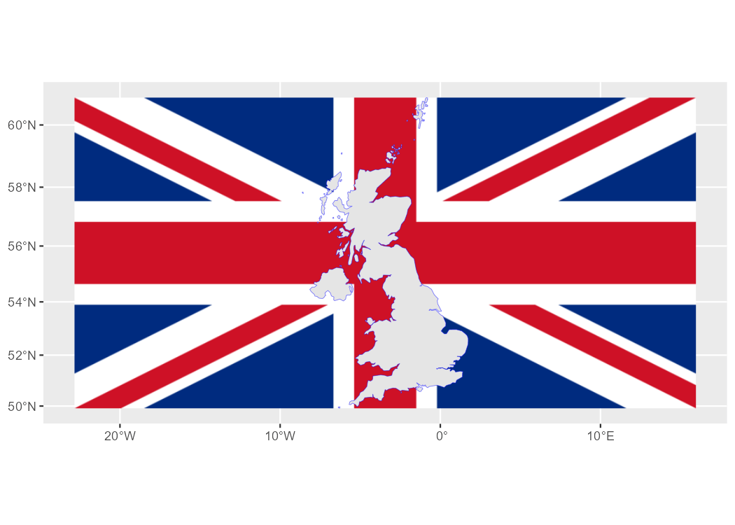
You can also adjust the expansion, alignment, cropping and masking options:
# Align, crop and mask the image.
uk_flag2 <- rasterpic_img(uk, img, halign = 0.2, crop = TRUE, mask = TRUE)

autoplot(uk_flag2) +
  geom_sf(data = uk, fill = NA)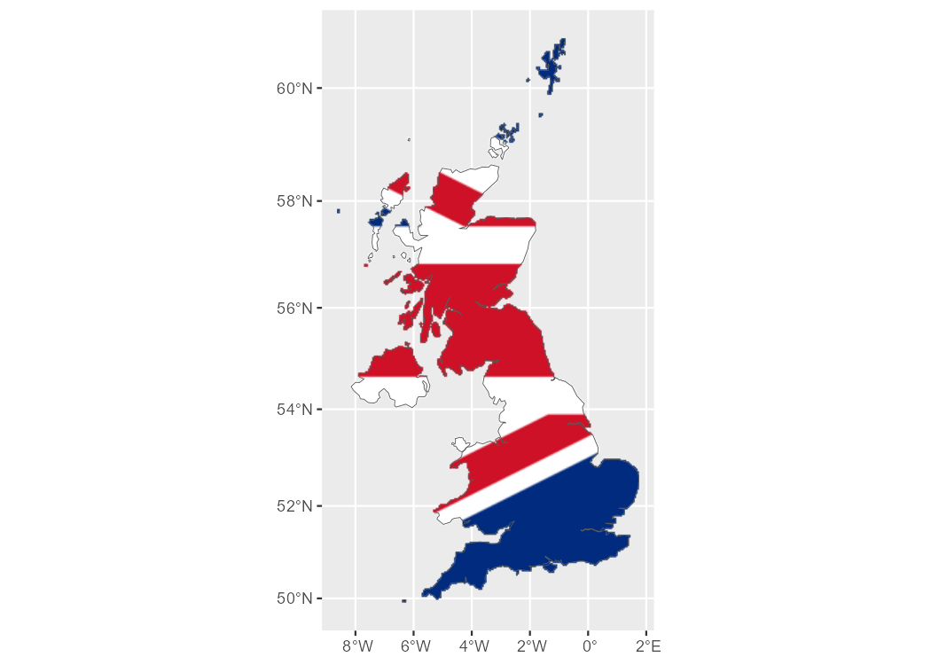
rasterpic can read the following image formats:
png files.jpeg/jpg files.tiff/tif files.Hernangómez D (2026). rasterpic: Convert Images to Spatially Referenced SpatRaster Objects. doi:10.32614/CRAN.package.rasterpic. https://dieghernan.github.io/rasterpic/.
A BibTeX entry for LaTeX users is:
@Manual{R-rasterpic,
  title = {{rasterpic}: Convert Images to Spatially Referenced {SpatRaster} Objects},
  doi = {10.32614/CRAN.package.rasterpic},
  author = {Diego Hernangómez},
  year = {2026},
  version = {1.0.0},
  url = {https://dieghernan.github.io/rasterpic/},
  abstract = {Convert digital images to spatially referenced SpatRaster objects, as defined by the terra package, using coordinates from supported spatial input classes. Supported inputs include numeric coordinate vectors and objects from the sf, terra and stars packages. The main function is an S3 generic, allowing other packages to extend support to additional spatial classes.},
}
These binaries (installable software) and packages are in development.
They may not be fully stable and should be used with caution. We make no claims about them.
Health stats visible at Monitor.